
Skokie, Illinois. That is where the heavy lifting happens for Rand McNally & Company. They are not just a publisher. They are a printer. And a mapmaker. And a globe spinner. If you have ever held a road atlas or a tourist guide in a rental car, you probably touched their work. They are the oldest firm of their kind in the United States. One of the largest in the world too.
It started with William H. Rand and Andrew McNally. They founded the business in 1856. They did not incorporate until 1873. By then, they had already pivoted. Their very first publication was not a map. It was an annual report for a railroad company. That came out in 1868. The first actual map followed four years later. 1872.
The company grew. Fast. They tapped into the booming need for business data. In 1877, they launched what is now the Commercial Atlas and Marketing Guide. Back then, it was called the Business Atlas. It helped companies locate markets. It helped them plan routes.
Then came the schools. A textbook department opened in 1894. The first book was the Rand McNally Primary School Geography. It taught kids where things were. Children’s books joined the list in 1900. But the real shift was coming. The automobile.
Around 1908, people started driving. They needed to know where to go. Rand McNally published its first road guide. It was a response to a changing America. Drivers needed routes. They needed landmarks. They needed to know which roads were paved.
The 1920s brought another milestone. Goode’s School Atlas debuted. Later renamed Goode’s World Atlas, it became a pioneer in school geography. It changed how students viewed the planet. It was not just about borders. It was about projection. Accuracy.
Today, the catalog is wide. You get maps. Atlases. Globes. Travel books. Reference guides. Custom maps. Wall maps that you pin to your kitchen. They even still do children’s books.
“The first publication was an annual report of a railroad company in 1868.”
Why do they matter now? GPS is everywhere. We have satellites. We have real-time traffic. We have digital screens in every car. Yet, paper persists. Why? Trust. Tangibility. A battery does not die. A map does not need a signal.
Rand McNally still prints. Still publishes. They are still in Skokie. The name remains. The methods have evolved. But the core job is the same. Show people where they are. And where they can go.
The market is shifting. Digital is winning. Print is niche. But niche pays. Especially when you are the oldest player in the game.
What happens when the last atlas is sold? The inventory clears. The servers take over. The history remains.
You can still buy their books. You can still order a custom map. It costs more than a download. Usually. But you get something back. Something you can hold.
Is that worth it? Maybe. Maybe not.

The cartography of credit
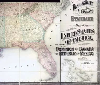
You look at an 1887 Rand McNally map and you see states. Borders. Rivers. What you don’t see is the ledger.
Behind every drawn line was a calculation. A risk assessment. Who owned the land? Who held the title? And more importantly, who held the debt against it?
This wasn’t just geography. It was finance. Mapped.
How land became collateral
In the late 19th century, the United States was expanding faster than its banking infrastructure could track. You needed a way to turn raw acreage into liquid capital. The solution was the mortgage.
But mortgages required trust. And trust required proof of ownership.
Enter the title.
Before modern digital registries, title was physical. It was a chain of deeds. A paper trail stretching back generations. If that chain was broken, the land was worthless to a lender.
“A map shows you where the land is. The title shows you who you can borrow from.”
This distinction matters today. When you buy a home, you aren’t just buying the structure. You’re buying the legal right to encumber it with debt. The map is static. The debt is dynamic.
Why ownership records matter
Consider the homestead acts. Millions of acres were distributed. But distribution wasn’t automatic. It required proof of settlement. Proof of improvement.
Many claims failed. Not because the land was poor, but because the paperwork was flawed.
A missing signature. A conflicting claim. A survey error.
These weren’t minor administrative hiccups. They were financial ruin. For the homesteader, it meant losing years of labor. For the bank, it meant a non-performing asset.
The map in the 1880s didn’t just show territory. It showed opportunity. And risk.
The hidden costs of clarity
Modern title insurance exists because the old system was fragile.
Back then, if you bought land from someone whose title was clouded, you owned a problem, not a property. Banks refused to lend on cloudy titles. This slowed economic growth. It stifled innovation.
The push for clearer records wasn’t about bureaucracy. It was about liquidity.
When you know who owns what, you can lend. When you can lend, you can build. When you can build, you can trade.
The map was the canvas. The title was the currency.
Where the lines blur
Today, the lines are digital. But the stakes are the same.
A blockchain-based land registry promises transparency. It eliminates the middleman. It reduces fraud.
But it also removes the human element. The nuance. The historical context that sometimes explains why a boundary has shifted over time.
Clarity is valuable. But absolute clarity can be dangerous. It gives you a false sense of security. It makes you think the risk is gone.
It’s not.
It’s just moved.
What to watch
If you’re investing in real estate, don’t just look at the location. Look at the chain of title.
How many times has the property changed hands? Were there liens? Were there disputes?
These details don’t appear on a map. They’re buried in archives. In court records. In the quiet corners of county clerks’ offices.
Finding them is work